
What is DronAge?
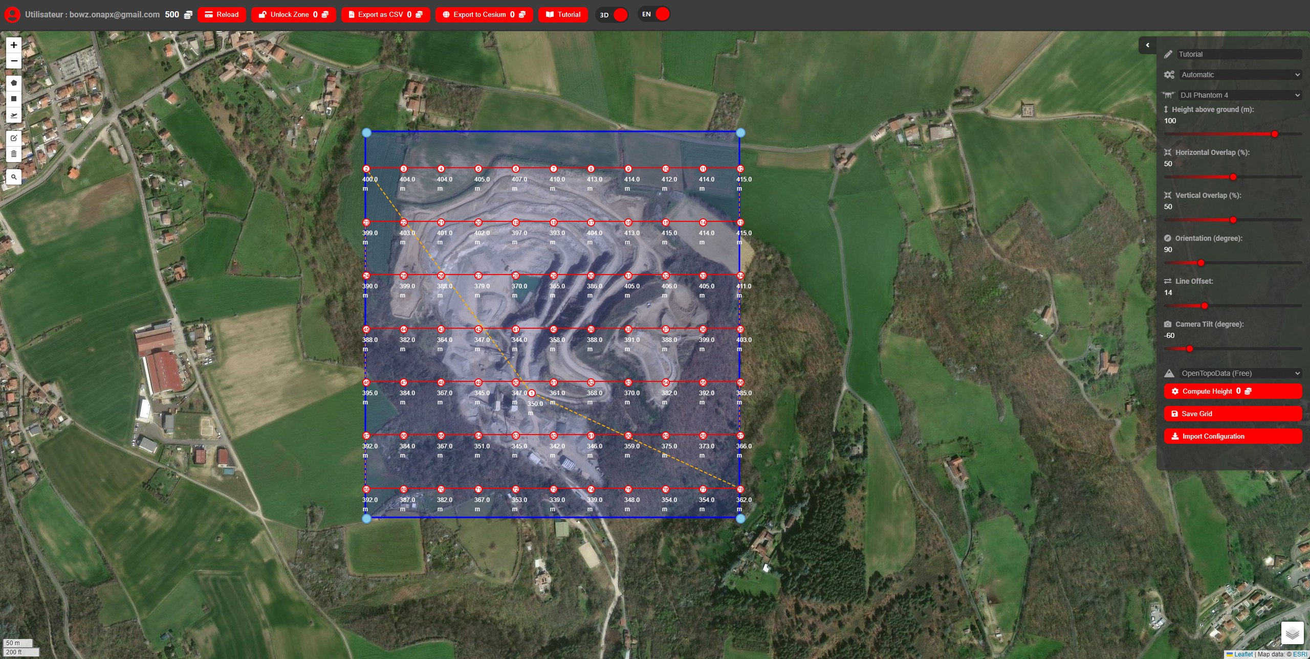
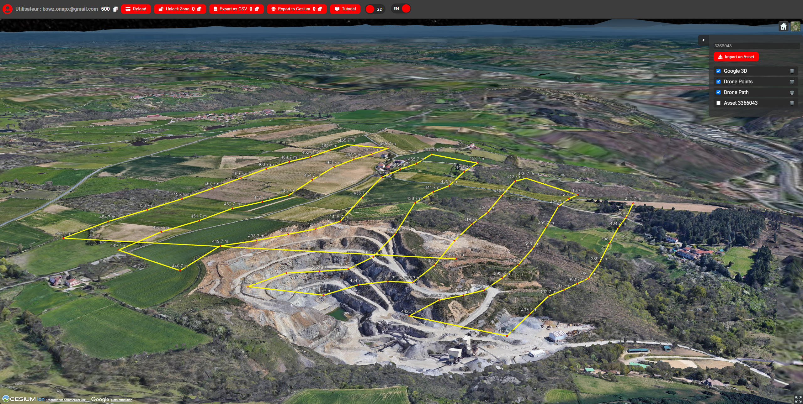
DronAge is a web-based platform designed for UAS pilots, surveyors, and mapping professionals. It allows you to create precise 3D waypoint grid missions for drone mapping, integrating terrain data (DEMs), photogrammetry assets, and exporting missions in Litchi-compatible CSV format.
Key Features
🚀 Upcoming Features
🎁 Beta & Credits
Why Use DronAge?
How It Works
FAQ
Is DronAge compatible with my drone?
Any drone compatible with Litchi CSV import is supported.
Can I use my own DEM?
Yes, you can upload your own Digital Elevation Model for precise terrain following.
Is there a free version?
You can use most features for free, with some premium options (e.g., Google Elevation API) requiring credits.